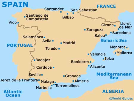
Malaga Airport (AGP)
City Orientation and Maps
(Malaga, Spain)
Located on the Costa del Sol, Malaga is a stunning coastal resort and can be found on the country's southern shore. Many further beach resorts lie close by, including Rincón de la Victoria to the east, and both Torremolinos and Benalmadena to the south-west, just minutes from Malaga Airport (AGP). Also nearby and slightly further to the south-west are both Fuengirola and Marbella. Malaga is approximately 58 km / 36 miles from Marbella and can be reached in around 50 minutes.
Malaga Airport (AGP) Maps: Important City Districts
Malaga is a large city and has a population of more than 550,000. A typically Spanish city, much of Malaga is based around its busy port, which is set against a magnificent stretch of shoreline and the Mediterranean Sea. The resort is extremely historic, whilst also being full of modern attractions and buildings, including many high-rise beachfront apartment blocks.
The very centre of Malaga features a number of narrow streets and boulevards, often lined with trees and close to many impressive gardens and monuments. Two of the city's main arteries, the Alameda Principal and the Paseo del Parque, are sited along the southern side of the old town neighbourhood, with the nearby Gibralfaro hill dominating much of the area. Other notable roads include the Calle Marqués and the Calle Molina Lario, both of which run northwards, into the centre.
Spain Map

Malaga Map


