Malaga Airport (AGP)
Driving Directions / Travel by Car
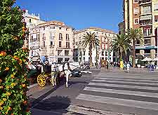
(Malaga, Spain)
Malaga Airport (AGP) is the chief air gateway into Spain's popular Costa del Sol region. The airport is well positioned on the main E-15 road and can be accessed easily from all parts of Malaga city centre, being located to the south-west.
Lying off the busy N-340 highway, Malaga Airport is located on the south-eastern perimeter and is also known as the Avenida de Velázquez. The facility is clearly signposted along all main routes as the 'Aeropuerto de Málaga', its local Spanish name.
Located close to the coastline, many areas of interest are just a short distance away from Malaga Airport. To the north you will find San Carlos, Puerto Sol and El Tomillar, while Romeral, Mestanza and Zapata are all just minutes away to the west. Directly south of Malaga Airport are a number of notable beachfront resorts, including Playamar, Torremolinos and Benamaida.
Directions to Malaga Airport (AGP) from the north:
- From destinations north, take the N-331 southbound until you meet with the E-15
- Follow the E-15 south to the airport
Directions to Malaga Airport (AGP) from the south:
- Take the E-15 north and follow the signs for the airport
Directions to Malaga Airport (AGP) from the east:
- Coming from the east, the E-15 west connects with the airport
Directions to Malaga Airport (AGP) from the west:
- Take the E-357 east, following signs for the airport
Malaga is a busy city and its roads have the potential to become congested at busy times of the day. We recommend that you allow plenty of travel time for your journey to the airport, leaving extra time in your schedule to account for any possible delays.
Malaga Airport (AGP): Virtual Google Maps
